Mapping
Roboauto’s mapping HW set and in-house made software enables mapping of the surroundings with high accuracy (HD maps) or creating a completely identical digital form of the environment (digital twins). This data is necessary not only for autonomous driving. Its use is becoming more and more important nowadays. It can have a huge impact, for example, in the construction industry, where it is used for project planning, work automatization or help cities manage (locate, count, or improve) their assets.
- Centimeter-level accuracy thanks to RTK and PPK.
- Variable hardware set for implementation on different platforms.
- Optimal sensor selection for high-quality outputs.
- Open and modular system for various projects.
Deployments
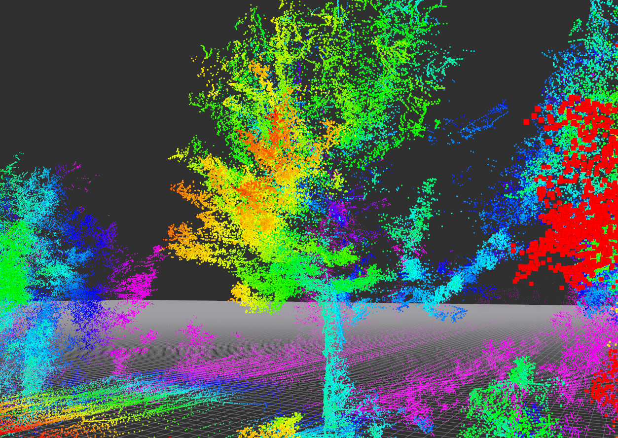
Detection of the trees along the road
All trees along the roads must be continuously checked and mapped. In the recent past, this diagnosis was carried out manually. One by one, the trees were measured, geolocalized, photographed, and checked for defects. Thanks to Roboauto’s mapping set, this work is done automatically. All trees along the road are recorded by the tree-mapping sensor set installed on a car. The recording is processed, and the output is the tree’s photo with its parameters, such as location, height, or width.
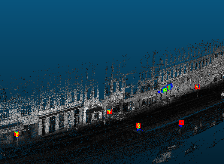
Road signs control
Roboauto designed and created a mapping set that enables the detection and classification of road signs. This job is performed repeatedly to ensure that road signs are clean, undamaged, or not missing. Thanks to Roboauto’s Record&Replay software, the operator can compare the older and newer recordings of the same section of the road and immediately detect missing or damaged road signs.
Hardware & Technologies

C++

roboCORE
Sensorics

Libraries
HW Platform
Summary of this solution
Do you want to know more about our Mapping solution, or do you need a concise summary that you want to show or print for your colleagues? No problem. Get this one!